If anyone has any questions about any past editions, any of the questions on the examinations, or on any of our State Specific courses, such as standards of practice or ethics, post them here and I will do my best to answer them. If you have any other open questions that you would like to ask, post them here as well.
Best Regards
Jeff Lucas
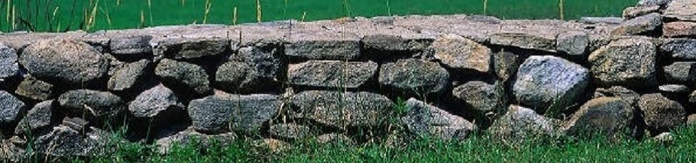
Hi everybody. I am a young surveyor in north central Ohio which is an area that served as a testing ground for the public land survey system. The original subdivisions in the north central/ northeastern part of Ohio are a little more standardized than the metes and bounds system found in the Colonial States, but are not sectionalized as they are in the PLSS. What the local surveyors seem to wrestle with is the principle found in Boundary Control and Legal Principles (among other places) that says a monument should only be used if it is called for in the deed. As it just so happens, many of the legal descriptions written in this area throughout most of the 20th century made no calls or sporadic calls to monuments. This has caused surveyors to not use monuments that have been in the ground for decades in favor of deed bearings and distances. I have taken the approach taught by Jeff that the property owners establish their property lines by way of mutual acceptance and the passing of time and that uncalled for monuments should be left in repose as long as they are mutually accepted. If questioned as to why I would hold uncalled for monuments with no pedigree what would be my best defense? Also, if you had to point to one legal reference that most clearly indicates that the property owners establish their property lines what reference would it be?
I totally agree with your approach Tim. In Idaho, surveyors were not required to file records of survey until the late 1970s. There was almost a century of development and surveying conducted between the original GLO surveys and the recordation law. Not only were calls to monuments usually not included in deed descriptions, but surveys were conducted to locate boundaries described in deeds and corners were set but no new descriptions prepared.
A good read about monuments is a paper by Chuck Karayan LS titled “Survey Monuments And the Law”. A google search will find it. Years ago I attended a seminar by Mr. Karayan in which he stated that if you really want to understand the principals described in the survey texts you should read the court cases they come from.
You are absolutely correct and thanks for giving information about open questions . I loved your blog and thanks for publishing this!! I am really happy to come across this exceptionally well written content. Thanks for sharing and look for more in future!!
Mr. Lucas, it seems you are idolized here in Arizona among surveyors. When they ignore the BLM Manual, Clark and Brown, they refer to you. Clearly they did not understand your POB articles that states your presentation is general and not specific to their task at hand.
I hope you can clear up the notion that in sectionalized lands that have been transferred to a state, with a state declaring the BLM Manual will be used, that federal monuments are not useless.
Also, in Clark 5th Edition, I would like to see you present your opinion on 4.02 Dignity of Official government surveys, specifically, paragraph 2 “The original section lines,”
Maybe also giver your opinion on Olson v. Jude in relation to monuments and their authority over none authoritative monuments, such as a random monument set by private surveyor in error.
Thank you for your comments Mr. Hack. Sorry for the delay in responding. I have been traveling almost constantly for the last four weeks and have not had the time to give your comments serious attention.
As a threshold matter, I rarely make comments about lands that are owned by the federal government and I do not recall making any comments about lands “that have been transferred to a state.” The vast majority of my comments on surveying boundaries have to do with private property ownership where the lands have been transferred into private hands and the federal government (or the state) have no more interests. I also talk about the good faith efforts of the private landowners to locate their properties and the bona fide rights that subsequently attach. As noted in the BLM Manual, federal law prohibits the Secretary of the Interior from conducting “resurveys or retracements” that “impair the bona fide rights or claims of any claimant, entryman or owner of lands affected by such resurvey or retracement.” Sec. 1-20, 2009 Manual and earlier editions.
Further, the BLM Manual warns that it assumes no control “over the acts of local and county surveyors.”
“The Bureau of Land Management assumes no control or direction over the acts of local and county surveyors in the matters of subdivision of sections, evaluation of evidence of corner locations, and reestablishment of lost corners of original surveys where the lands have passed into private ownership, nor will the Bureau of Land Management issue instructions in such cases. It follows the general rule that disputes arising from uncertain or erroneous location of marked or unmarked protracted corners originally fixed by the United States are to be settled by the proper local authorities or by amicable adjustment. The Bureau of Land Management desires that the rules controlling the acts of its own cadastral surveying service, and other surveyors under its direction and control, be considered by all other surveyors as merely advisory and explanatory of the principles that should prevail in performing such duties.” Sec. 3-135,2009 Manual and earlier editions.
So, if as you say the state requires that the “BLM Manual will be used,” then I suppose the state accepts this premise as well. The discussion I have relative to the BLM Manual usually revolve around what the Manual actually says as opposed to what many surveyors assume or just believe that it says. Who the federal government intended to further subdivided the sections (the local surveyor), who was charged with good faith efforts in finding the location of their property on the ground (the landowners not surveyors) and who acquires bona fide rights as a result of those good faith efforts (the landowners not surveyors). It’s all about the landowners, not the proper or improper procedures of land surveyors.
From the 2009 Manual of Surveying Instructions, which is the applicable federal agency’s articulation of federal land law, first enacted under the Land Ordinance of 1785, et seq., relative to the further subdivision of the sections we find the following:
1-1. The corner monuments on the ground established actual on-the-ground locations for the boundaries of the lands entered, patented, and/or otherwise conveyed. This process assures the orderly disposition of the public lands and avoids confusion and contention.
3-4. By law, (1) the corners marked in public land surveys shall be established as the Proper corners of sections, or of the subdivisions of the sections, which they were intended to designate ….
3-4. (2) the boundary lines actually run and marked shall be and remain the proper boundary lines of the sections or subdivisions for which they were intended, and the lengths of these lines as returned shall be held as the true length thereof ….
3-131. The function of the local surveyor begins when employed as an expert to identify lands that have passed into private ownership. This may be a simple or a most complex problem. …
3-132. The work of the local surveyor usually includes the subdivision of the section into the legal subdivisions shown upon the approved plat. In this capacity, the local surveyor is performing a function contemplated by law. He or she cannot properly serve the client or the public unless familiar with the legal requirements concerning the subdivision of sections.
3-135. The Bureau of Land Management assumes no control or direction over the acts of local and county surveyors in the matters of subdivision of sections, evaluation of evidence of corner locations, and reestablishment of lost corners of original surveys where the lands have passed into private ownership, nor will the Bureau of Land Management issue instructions in such cases.
3-99. In the public land survey system a corner is fixed in position by operation of law. Corners marked in official surveys followed by use are fixed in position by monuments. Only a small portion of corners are marked on the ground in original surveys. Subdivision-of-section corners are generally not marked. Their positions are fixed on the plat by protraction. Their positions are fixed on the ground by the survey process of running (and marking) line between marked corners, and setting monuments.
3-137. The protracted position of the legal subdivision corner on the survey plat is merely the first step in fixing the position of a corner. The corner position is fixed by the running and marking of the lines.
3-137. A decision to set aside previously fixed local survey legal subdivision corners must be supported by evidence that goes beyond mere demonstration of technical error, reasonable discrepancies between former and new measurement, and less than strict adherence to restoration and subdivision rules. [Emphasis added.]
Thus, the “fixed local survey” is the “legal subdivision.” Just going by what the Manual says.
Jeff